-


Follow Us

An unusually cold system is impacting the Pacific Northwest this week, bringing several inches (as much as up high) to the region by Tuesday night. The most favorable zone will be central and southern Washington and northern Oregon, with the bullseye being right on Mt Hood (who also has the advantage of higher elevation, which is very important with these late-season storms).
Snowfall will start in northern Washington before working south over the course of Sunday night. Things really start to intensify mid-Monday morning in southern Washington and northern Oregon. Precipitation will calm down in the afternoon and evening before a secondary wave pushes through between Monday night and Tuesday evening. Below: snowfall from Sunday evening through Tuesday night.
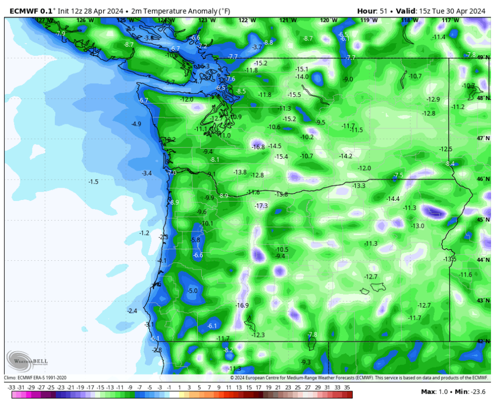
Unusually cold temperatures for this time of year will allow snow levels to fluctuate between 2,000 and 4,000 feet. The snow that does fall will be uncommonly high-quality, so get out and ski it if you can! Below is the projected surface temperature anomaly (departure from seasonal average) on Tuesday morning:
By Wednesday morning, here are realistic storm totals from the two storms for resorts that are still operating at least on weekends:
- Mt Hood: 18-22"
- Crystal: 11-14”
- Bachelor: 8-11”
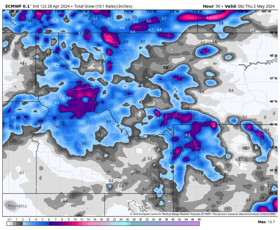
These same systems will eject east into the Intermountain West, bringing widespread 3-8" totals in Idaho, Montana, and Wyoming. Below is the ECMWF forecast for Idaho, Montana, and Wyoming by Wednesday night:
Light snow will bring a few inches to Colorado on Tuesday morning with more on Wednesday night (uncertainty remains very high, but totals will likely be less than 6 inches).
Happy chasing!
More must-reads:
- Rangers defenseman wins Mark Messier Leadership Award
- Details emerge on Jason Kelce’s role at ESPN
- The 'No. 1 overall NBA draft pick' quiz
Breaking News
Customize Your Newsletter
 +
+
Get the latest news and rumors, customized to your favorite sports and teams. Emailed daily. Always free!